
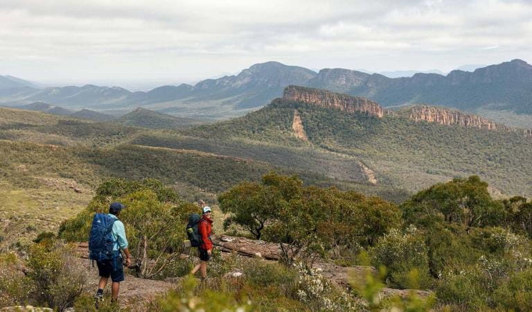
The Falls to Hotham Alpine Crossing is a 37km three-day hike through the Alpine National Park from Falls Creek to Mt Hotham. Enjoy spectacular views of mountain ridges from 2000m above sea level, walk through beautiful Snow Gum woodland and camp near two historic huts.
Winding its way along alpine ridges through snow gum woodlands and snow grass plains, over rocky summits and past historic huts, this memorable hike rewards walkers with a spectacular view at every step. By night, see thousands of twinkling stars against some of the darkest skies in the world far from light pollution.
The trail is divided over three legs as follows:
Day 1: Falls Creek to Cope Hut, 14km
Day 2: Cope Hut to Dibbins Hut, 14km
Day 3: Dibbins Hut to Mt Hotham, 9km
Day 1 highlights include lookouts at Heathy Spur, historic Wallace Hut and Cope Hut - and swathes of pink, gold and white wildflowers in spring and summer. On Day 2, there are stunning panoramas from Pole 333 and unforgettable views of Mount Feathertop, Victoria's second-highest mountain. Day 3 highlights include abandoned Quintet Mine, charming Derricks Hut - and of course a well-deserved coffee and cake at Mt Hotham!
How to get there
Falls to Hotham Alpine Crossing
Falls to Hotham is a point-to-point walk, so you’ll need transport to the start and a way to get home at the end. The drive between trailheads takes approximately two-and-a-half hours.
Using two vehicles in a car shuffle is a popular option. Drive in convoy to the end of the walk, drop off one vehicle, then return to the start of the walk in the other vehicle. Vehicles can be left at the Heathy Spur or Mt Loch car parks at either end.
If you’re staying at Falls Creek, Mt Hotham or Dinner Plain before your walk, some accommodation providers can offer transport or assist with a car shuffle.
When you're there
The Falls to Hotham Alpine Crossing is accessible for hiking from November to April. The track can be walked in either direction but is best when starting from Falls Creek and walking towards Mt Hotham.
There are two campsites on the Falls to Hotham Alpine Crossing:
Cope Hut Camping Area, among the Snow Gums on the Bogong High Plains, is 14km from the trailhead and usually the first night's campsite.
Dibbins Hut, on a snow plain near the headwaters of the Cobungra River, is 9km from Mount Hotham.
Each campsite has five sites on tent platforms. There are four 3m x 3.7m platforms and one larger platform that is 4.5m x 3m. The platforms are designed to fit a 2-3 person hiking tent.
The tent platforms are designed for you to pitch your tent directly on the platform. Each platform has eyelets around the edge to hook tent peg loops or guy ropes over. As well as these there are movable pegs that slot into the mesh, allowing tents of all shapes to be set up.
Bookings are required to so be sure to check availability and make a booking prior to your trip.
Need to know
Falls to Hotham Alpine Crossing
Accessibility
Visiting a park can be more of a challenge for people with disabilities, however in Victoria there are a wide range of facilities to help people of all abilities enjoy our wonderful parks around the state.
How we keep it special
The Falls to Hotham Alpine Crossing immerses visitors in the alpine environment, with its gnarled snow gums and fields of alpine daisies, surrounded by high country scenery, passing by heritage huts and walking to the summits of some of Victoria’s most spectacular peaks. The Master Plan for the Falls to Hotham Alpine Crossing outlines the proposed development of a five-day, four-night hiking experience that traverses the Great Dividing Range, from Falls Creek to Mount Hotham.
Change of Conditions
Nature being nature, sometimes conditions can change at short notice. It’s a good idea to check this page ahead of your visit for any updates.
-
Pinnacles Lookout Day Visitor Area (Pinnacle Ck - East Branch Natural Catchment Area, Alpine National Park)
Pinnacles toilet CLOSED until further notice
The drop toilet located at the Pinnacles lookout is closed until further notice due to maintenance requirements. The closest alternative toilet is at Horseyard Flat, Alpine National Park.
We apologise for any inconvenience. -
Moroka Hut and Camping Area (Alpine National Park)
Moroka River Pedestrian Bridge CLOSED until further notice
The Moroka River pedestrian bridge is closed until further notice due to being assessed as structurally unsound.Access to Moroka Hut is via the Moroka Range Walking Track (4WD only). -
Alpine National Park
Eastern Alps track closures due to storm and flood damage
The 4x4 tracks in the Eastern Region are an iconic part of Victoria and an important focal point for many people. With a large number of visits per year, they are very popular for outdoor activities such as camping, hiking, mountain biking and four-wheel driving.Unfortunately, sometimes we must close infrastructure in the interests of public safety and environmental protection.
The following tracks have been significantly damaged by storms and floods and are currently closed to motor vehicles to ensure public safety and environmental protection:- Cobberas Track
- Macfarlane Flat Track
- Ingeegoodbee Track
Before visiting, Visitors should always check the Parks Victoria website for the latest information about their destination.Road maintenance - Tamboritha Road
Road maintenance is currently underway on Tamboritha Road in the Foothills & Southern Alps area of the Alpine National Park. There will be an increase in Truck movements and equipment operating along Tamboritha Road between Bennison Gravel Pit and Arbuckle Junction.Please be aware traffic management is in place with possible delays. Always adhere to signs and please drive carefully and to the conditions.Restricted Access at Eastern end of Spring Saddle Track
The eastern end of Spring Saddle Track has restricted access due to machinery continuing to clear soil as part of the Bogong Village landslip remediation works. The track is open to pedestrian traffic but not vehicles and no Park visitors will be able to enter the works site at the Eastern end of Spring Saddle Track. There is signage explaining the restrictions at the Spring Saddle Track Fainter Fire Trail intersections.Bogong High Plains Road
Following the landslide at Bogong Village the Bogong High Plains Road is now open however remediation work will continue into the foreseeable future to rectify the damage created by the landslide. Parks Victoria advises that all visitors check the Regional Roads Victoria and Victoria's big build website for the latest traffic updates on closures or delays before visiting.https://regionalroads.vic.gov.au/map/north-eastern-improvements/bogong-high-plains-road-landsliphttps://bigbuild.vic.gov.au/projects/mrpv/bogong-high-plains-road-landslipGround shooting operations targeting Feral Pigs Eastern Alps from 15 April 2024.
Ground operations (ground shooting) targeting Feral Pigs are undertaken across the Eastern Alps, and include areas to the west and north of Suggan Buggan, west of Wulgulmerang, and east of Cobberas and Brumby. The Park will remain open to visitors during operations.
This work is to be carried out dusk to dawn from:
* 15 to 26 April, and
* 29 May to 15 June 2024.Attachments: Flyer for feral pig control FINAL (165KB)
Mt Pinnibar Track - poor track conditions
Mt Pinnibar Track, between Walkers Road and Tom Groggin Track, has developed sections of significant and deep track erosion following flood and storm events.While the track remains open it is recommended that only experienced drivers in well equipped 4WD vehicles attempt this track in dry conditions.All visitors are advised to consider alternate routes to the summit of Mt Pinnibar until repairs can be carried out.Road Conditions – Tamboritha and Howitt Roads
Tamboritha and Howitt Roads in the Foothills and Southern Alps area of the Alpine National Park are currently recommended for all wheel drive and four wheel drive vehicles with sufficient clearance and appropriate tyres. Road maintenance works have been completed on sections the Tamboritha and Howitt Roads in summer 2024, however some road surfaces conditions remain poor.Vehicles travelling on the these roads require attention to variations of the surface condition.Allow more time for your journey and always drive to the conditions. - Cobberas Track
-
Notices Affecting Multiple Sites
TRACK CLOSURE: Wild Horse Gap Track, Alpine National Park
Wild Horse Gap Track is currently closed as a result of poor track condition until further notice.Access to the park is not affected - alternate routes are available that will enable transit through this section of the Alpine National Park. If you require assistance with journey planning as a result of the closure, please contact the local Parks Victoria office for assistance via 13 19 63. -
Notices Affecting Multiple Parks
Ground shooting operations targeting deer
Control operations (ground shooting) targeting deer are undertaken in this area. The Park will remain open to visitors during operations. -
Federation Hut (Alpine National Park)
Water tank at Federation Hut is currently empty.
The water tank at Federation Hut is currently empty and will not be replenished until significant rainfalls.The nearby springs have also slowed up, so walkers should consider taking their own water with them and not be fully reliant on those springs in case they do stop flowing.
Similar experiences
Grampians Peaks Trail
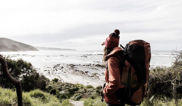
Great Ocean Walk
