
Explore
Wingan Inlet Campground
Come prepared with a canoe or kayak and explore the Wingan River. Upstream, the river follows a winding course through sea rushes and paperback thickets to a towering littoral rainforest and the stunning Wingan River Rapids. Crystal clear water trickles through lichen-covered granite boulders and curious water dragons peer out from behind colourful wildflowers. Downstream, the river leads to the mouth of the inlet where sandbars give way to the wild ocean swells of Fly Cove.
A small network of rocky islands just off the white sands of Fly Cove are home to a colony of Australian and New Zealand Fur Seals. Listen carefully and you might be lucky enough to hear pups calling for their mothers.
Along with the Wingan River Rapids, Fly Cove can be accessed by foot from the camsites. Follow the Fly Cove Walk. The beginning of the Wingan Rapids walk begins from Boundary Track, a short drive from the campsites.
If you're a keen angler, try your luck fishing and you might just catch dinner. Tailor, bream, perch and salmon are some of the species found in the inlet. If you're fishing from a boat, please note that Wingan Inlet has a 20 hp motor size limit.
Things To Do
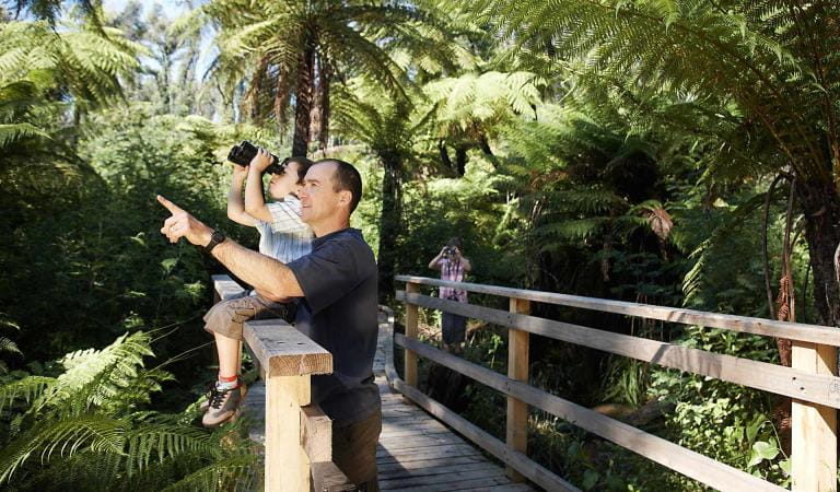
Bird watching
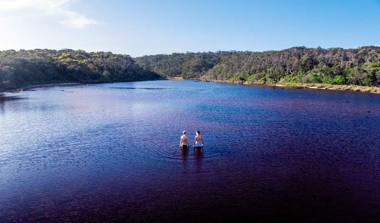
Elusive Lake
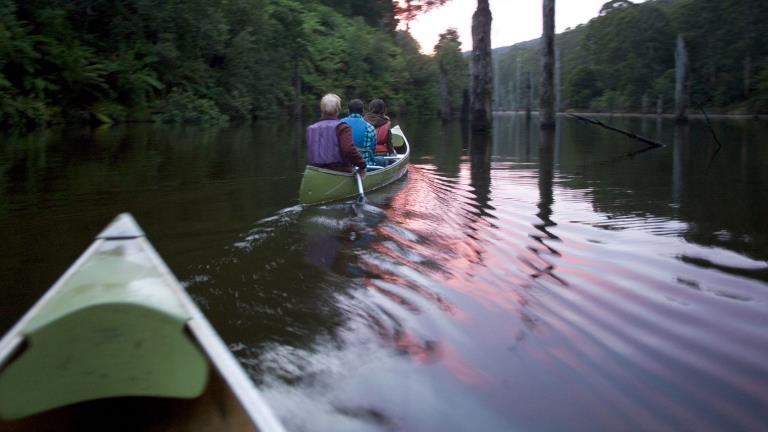
Canoeing and Kayaking
How to get there
Wingan Inlet Campground
Sites
When you're there
When to go
Flathead, whiting, yellowfin, bream and perch are most likely to bite from late spring to autumn. Throughout winter large schools of Black Bream make their way into the estuary. And tailor, salmon and trevally are also known to bite throughout June, July and August.
Need to know
Wingan Inlet Campground
Accessibility
Wingan Inlet contains a number of campsites that are relatively flat set in clear, open areas. But note that there's a lack of accessible toilets and the trails leading down to Fly Cove are narrow and steep in some sections.
Be prepared and stay safe
Croajingolong National Park is in the East Gippsland fire district. Bushfire safety is a personal responsibility. Anyone entering the park during the bushfire season needs to stay aware of forecast weather conditions. Check the Fire Danger Rating and for days of Total Fire Ban at emergency.vic.gov.au, on the Vic Emergency App or call the Vic Emergency Hotline 1800 226 226.
No fires may be lit on Total Fire Ban days. On Catastrophic Fire Danger Rating days this park will be closed for public safety. Closure signs will be erected but do not expect an official warning.
Change of Conditions
Nature being nature, sometimes conditions can change at short notice. It’s a good idea to check this page ahead of your visit for any updates.
-
Wingan Inlet Campground (Croajingolong National Park)
Track closures at Lake Elusive, Wingan Rapids and Mt Everard
Track repairs and slashing will be conducted at Lake Elusive, Wingan Rapids and Mt Everard tracks from Mon 13 May to Fri 17 May. These areas will be closed to the public. Visitors to Croajingolong should be aware of additional trucks and roadwork signage on West Wingan Rd.Road works on West Wingan Rd
Road works will be in progress from May 15 to May 31 on West Wingan Rd near Wingan Inlet campground.
Visitors should be aware of additional heavy traffic on the road, speed limits and traffic control. -
Croajingolong National Park
Aerial shooting operations targeting deer – Cape Howe
Partial park closures will be in place during these dates while aerial shooting operations targeting deer are undertaken.18-22 March 202425-27 March 202416-20 September 20249-13 December 2024See attached map for details.Attachments: Cape Howe aerial operations information (632KB)
Aerial shooting operations targeting deer
Partial park closures will be in place during these dates while aerial shooting operations targeting deer are undertaken.18-22 March 202425-27 March 202416-20 September 20249-13 December 2024See attached map for details.Attachments: Croajingolong NP aerial operations information (523KB)
Closure of the Goanna bay Jetty
Parks Victoria has recently closed the Goanna Bay Jetty (Mallacoota Inlet) for public safety reasons.The closure follows condition monitoring of the jetty that raised some concerns about its safety and structural integrity. A subsequent engineering assessment confirmed that the jetty’s condition was no longer safe for visitors.The jetty was closed on Friday 10th November and will remain so until further notice.Please note that the Goanna Bay day visitor area remains open to the public. However visitors will not be permitted to use the jetty during the closure period and will have to rely on alternative methods of safe access such as beaching or anchoring vessels to the shoreline.Croajingolong National Park information update 12 February 2024
Point Hicks Road is closed south of Bald Hills.The following six areas are closed because of the 2019/2020 bushfires and coastal erosion caused by ongoing heavy rainfall. Visitors are unable to access the Point Hicks Lighthouse, Thurra River Campground, and nearby walking tracks. Parks Victoria continue to maintain surveillance and security of these areas. Please continue to monitor this site for updates and change of conditions.· Point Hicks Lightstation· Thurra River Bridge· Thurra River Campground· Dunes Track· Saros Track· Sledge TrackThe Wilderness Coast Walk is open all the way from Bemm River to Mallacoota. Staff have recently marked sections of the track however, combined flood and fire damage have made some areas more difficult to negotiate. Hikers must be able to self-navigate with a map and compass.The following walking track is closed:· Wingan Inlet Rapids WalkThe following jetty around Mallacoota is closed:· Kingfish PointSeasonal road closures generally operate from after the long weekend in June through to the end of October, but many remain closed in areas affected by significant rainfall and flooding across Victoria in late 2022. The following tracks remain closed:· Betka Track· Miners Track· Lakeview Track· Howe Flat Track· Howe Hill Track· Barracoota TrackThe water trough at Wingan Inlet Campground is now reconnected to the creek. Visitors are reminded that this is not a potable source and must be treated before drinking.Ongoing heavy rainfall has impacted areas of Croajingolong National Park and other areas of the state. Monitor this page for updated information and site closures -
Notices Affecting Multiple Parks
Ground shooting operations targeting deer
Control operations (ground shooting) targeting deer are undertaken in this area. The Park will remain open to visitors during operations.