
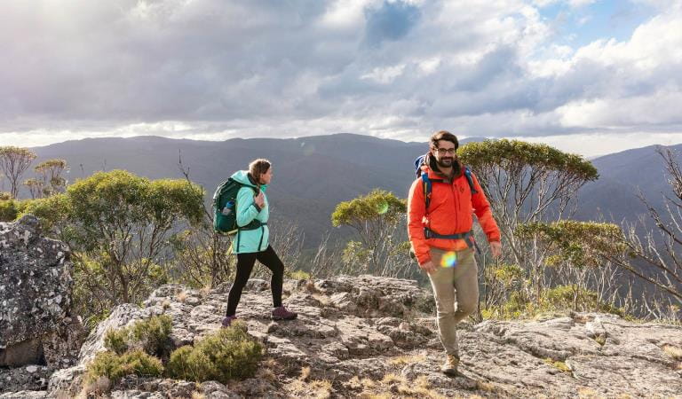
A more challenging walk departs from the aptly named Wonderland carpark and ascends via the impressive Grand Canyon. It does not resemble the American canyon of the same name but is equally impressive with its unique Australian rock formations, albeit on a smaller scale! The walk continues through the Silent Street before rising up to The Pinnacle.
For the really adventurous, you can walk to The Pinnacle from the base of the mountains, starting at the Halls Gap caravan park. This extended walk will take around five hours return so is suitable for fit and experienced walkers.
All these walks offer a variety of incredible rock formations to see and negotiate, as well as lush vegetation that has recovered from bushfires with fresh spurts of new growth. In springtime, wildflowers burst into life with their brilliant bright colours. With an abundance of wildlife living in the park, your walk may also include glimpses of koalas, kangaroos, snakes, skinks and maybe even an echidna or two.
Whichever way you get there, the view from The Pinnacle lookout will astound you. While you get your breath back after your ascent, you will be able to see Halls Gap far below you, as well as Lake Bellfield. Plus you will get a close-up look at the irregular and fascinating rock formations for which the Grampians are so well-known.
The Pinnacle walks
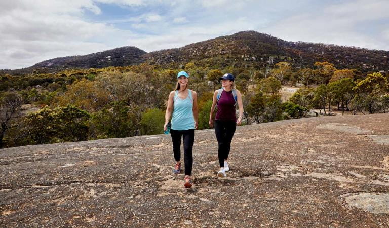
Hiking and bushwalking
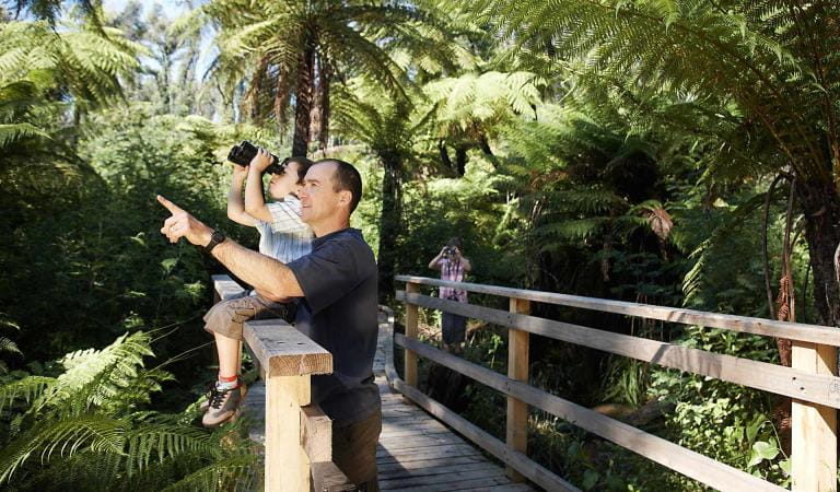
Bird watching
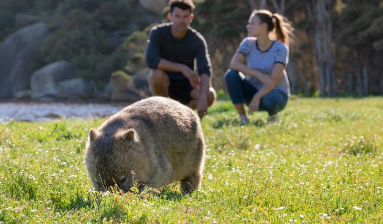
Wildlife viewing

Brambuk The National Park and Culture Centre
How to get there
The Pinnacle walks
When you're there
Need to know
The Pinnacle walks
Accessibility
Visiting a park can be more of a challenge for people with disabilities, however in Victoria there are a wide range of facilities to help people of all abilities enjoy our wonderful parks around the state.
Assistance dogs are welcome in Parks Victoria parks and reserves. Entry requirements apply for parks and reserves that are usually dog prohibited, such as national parks.
Change of Conditions
Nature being nature, sometimes conditions can change at short notice. It’s a good idea to check this page ahead of your visit for any updates.
-
Notices Affecting Multiple Sites
Grampians Peaks Trail – Helicopter Air-Lift Operations – 13.05.2024 to 15.05.2024
Helicopter Air-Lift Operations are scheduled along Grampians Peaks Trail (GPT) from Monday 13th May to Wednesday 15th of May 2024.This operation will take place across three days at various locations in the northern, central and southern sections of the Grampians Peaks Trail, and at other key visitor sites.Temporary closures of Hike-in campgrounds, roads, walking tracks, and trailheads will be required for helicopter operations as staff work to remove/replace toilet pods out of and into Grampians Peaks Trail Hike-in campgrounds.Signage will be installed at key closure points and staff will be on ground to assist with visitor safety. Please follow safety advice and remain clear of closed areas during the operation.Locations may change at short notice due to weather conditions. Should the operation be suspended, the works will re-commence when conditions are deemed favourable.Temporary ‘hold in place’ closures of up to 30 minutes will occur at:Helicopter Landing Sites (HLS)Roses Gap, Gar, Wartook East, Mt William, First Wannon, Yarram (ridgeline above Hike-in campground), Stockyard and Piccaninny East CarparkFyans Creek Helicopter Landing Site (behind Brambuk The National Park and Cultural Centre)GPT Hike-in CampgroundsBarigar, Gar, Werdug, Barri Yalug, Duwul, Durd Durd, Yarram and Mud-Dadjug Hike-in campgroundsGPT Trailheads/CarparksRedman Road Trailhead CarparkPiccaninny East Car Park (Note: Victoria Valley Road Trailhead access to the Piccaninny remains open)CampgroundsFirst WannonWalking Tracks/Management Vehicle Only tracks (MVO)Walking tracks, roads, and MVO's north and south of the GPT Hike-in campgrounds and helipads listedRoads around Dunkeld Reservoir and Piccaninny Car ParkFor further information, please visit Brambuk the National Park and Cultural Centre in Halls Gap or call 8427 2258.Grampians National Park - Autumn planned burn season underway
Grampians (Gariwerd) National Park – Autumn Planned Program UnderwayForest Fire Management Victoria (FFMVic) have commenced the Autumn Planned Burning Program in Grampians (Gariwerd) National Park and surrounding reserves.These planned burns have been nominated and approved as part of the FFMVic three-year Joint Fuel Management Program for the Wimmera Fire District. Each burn has been designated to a year and season, though this may change depending on burn objectives and seasonal conditions. You can view the three-year plan at https://www.ffm.vic.gov.au/bushfire-fuel-and-risk-management/joint-fuel-management-programThe map attached, outlines the burns programmed for this year. Detailing the exact date and time of ignition can be difficult and the final decision to proceed may only be made on the day of the burn - once resources, weather conditions and local fuel moisture levels are deemed suitable. Once a burn is scheduled for ignition, FFMVIC will send out regular notifications.Some of the planned burns this Autumn may involve the temporary closure of visitor sites, roads and campgrounds within Grampians Gariwerd National Park and other reserves. This may include detours or closures of hike in campgrounds along the Grampians Peaks Trail, and other vehicle-based campgrounds.· Closures will be enforced for the duration of ignition and may remain in place for some days. Visitor sites will re-open once the burn is declared safe.· We recommend that you seek information and stay informed about the status of the planned burns scheduled near you.Stay informed about this Autumns planned burns schedule:Visit & Sign Up:Sign up to Planned Burns Victoria to set up automated notifications about upcoming planned burns on public land near you. There is no charge to sign up to receive text messages.
Sign up via Planned Burns Victoria at www.vic.gov.au/plannedburnsDownload: the VicEmergency AppSet up a watch zone and choose to be notified about planned burns in the ‘alerts’ settingsCall: the VicEmergency Hotline on 1800 226 226 and request an interpreter or assistance for hearing difficulties via the National Relay ServiceEmail: For specialist advice about planned burns in the Wimmera District you can contact Horsham FFMVic Office at wimmera.fuelmanagement@delwp.vic.gov.au or phone the office on (03) 8508 1222.For Information about park closures and campground bookings within Grampians National Park:Visit the Parks Victoria website: https://www.parks.vic.gov.au/places-to-see/parks/grampians-national-park#change-of-conditionsVisit: Brambuk the National Park and Cultural Centre – 277 Grampians Road Halls Gap, Ph 8427 2058or for bookings and cancellations advice contact the Parks Victoria Information Centre Ph 13 1963 or email info@parks.vic.gov.auPlanned Burn Update – Cassidy Gap
FMVIC have now completed the following Planned Burn within Grampians (Gariwerd) National Park.Cassidy Gap (GR-WIM-CAV-00071)This burn is located 3km north of Dunkeld and includes section S3 of the Grampians Peaks Trail.The following visitor areas are now reopened, however, please adhere to “Don’t walk off the track” signage.· Grampians Peaks Trail (Section S3) north and south bound hiking between Cassidy Gap Rd Trailhead, over Signal Peak to Dunkeld Reservoir Road.· Mud-Dadjug Hike-in Campground.· Mt Abrupt carpark· Signal Peak walking trackThe following roads remain closed, please follow directions, and do not enter:· Serra Range Fireline is closed at the intersection of Vic Valley Road and Cassidy Gap Road· Cassidy Gap Road from closed from its intersection with Serra Range Fireline to its intersection with Grampians Rd.Visit & Sign Up: Sign up to Planned Burns Victoria www.vic.gov.au/plannedburns Set up automated notifications about upcoming planned burns on public land near you. There is no charge to sign up to receive text messages.Download: The Vic Emergency App. Set up a watch zone and choose to be notified about planned burns in the ‘alerts’ settingsCall: The Vic Emergency Hotline on 1800 226 226 and request an interpreter or assistance for hearing difficulties via the National Relay Service. IN AN EMERGENCY CALL 000Email: For specialist advice about planned burns in the Wimmera District you can contact Horsham FFMVic Office at wimmera.fuelmanagement@delwp.vic.gov.au or phone the office on (03) 8508 1222.For Information about park closures and campground bookings within Grampians (Gariwerd) National Park:Visit the Parks Victoria website: https://www.parks.vic.gov.au/places-to-see/parks/grampians-national-park#change-of-conditionsVisit: Brambuk the National Park and Cultural Centre – 277 Grampians Road Halls Gap, Ph 8427 2058 or for bookings and cancellations advice contact the Parks Victoria Information Centre Ph 13 1963 or email info@parks.vic.gov.auYou may see or smell smoke in the vicinity of the burn. For advice on how this may impact your health, visit www.epa.vic.gov.au/smokePlanned Burn Update - Millstream Creek
FFMVic have completed the following planned burn.
Millstream Creek (GR-WIM-HGP-0081)This burn is located 6km west of Halls Gap.The following visitor areas have now reopened, however, please adhere to “Don’t walk off the track” signage.
· Boroka Lookout· Reeds Lookout· Lake Wartook Lookout· Lake Wartook· Mackenzie Falls precinct· Boroka Walking Track· Mackenzie River Walk (includes Fish Falls)· Smiths Mill CampgroundThe following roads have now reopened:· Old Mill Rd· Rose Creek Rd (north between Mt Victory Rd and Old Mill Rd)Visit & Sign Up: Sign up to Planned Burns Victoria www.vic.gov.au/plannedburns Set up automated notifications about upcoming planned burns on public land near you. There is no charge to sign up to receive text messages.Download: The Vic Emergency App. Set up a watch zone and choose to be notified about planned burns in the ‘alerts’ settings
Call: The Vic Emergency Hotline on 1800 226 226 and request an interpreter or assistance for hearing difficulties via the National Relay Service. IN AN EMERGENCY CALL 000Email: For specialist advice about planned burns in the Wimmera District you can contact Horsham FFMVic Office at wimmera.fuelmanagement@delwp.vic.gov.au or phone the office on (03) 8508 1222.For Information about park closures and campground bookings within Grampians (Gariwerd) National Park:Visit the Parks Victoria website: https://www.parks.vic.gov.au/places-to-see/parks/grampians-national-park#change-of-conditionsVisit: Brambuk the National Park and Cultural Centre – 277 Grampians Road Halls Gap, Ph 8427 2058 or for bookings and cancellations advice contact the Parks Victoria Information Centre Ph 13 1963 or email info@parks.vic.gov.auYou may see or smell smoke in the vicinity of the burn. For advice on how this may impact your health, visit www.epa.vic.gov.au/smoke -
Grampians National Park
Mt Zero Road Closure – Mud Hut Creek bridge replacement – 7th May to July 2024
Mt Zero Road will be closed between Roses Gap Road and north of Heatherlie Quarry between 7th May and July 2024 while the Department of Environment Energy and Climate Action (DEECA) undertakes critical bridge replacement works approximately 100m south of Roses Gap Road.Visitors wishing to travel between Halls Gap, Roses Gap and the Northern Grampians area (Hollow Mountain, Mt Zero and Mt Stapylton) will need to follow a detour via Ledcourt and Lake Lonsdale areas. See attached map.Plantation Campground and Heatherlie Quarry are still accessible from Mt Zero Road south (Halls Gap) or Pines Road.For further information on national park access please contact Brambuk the National Park and Cultural Centre phone 8427 2058Attachments: Mud Hut Creek - Bridge Works 2024 (584KB)
Grampians (Gariwerd) National Park - Bushfire Closures Update - April 26, 2024
Grampians (Gariwerd) National Park was impacted by the Bellfield and Stapylton bushfires from 13th February 2024. There are temporary closures still in place in the vicinity of the fires. Visitors are asked to adhere to road and park closures as we work to assess and re-open these areas.Northern Grampians (Mt Stapylton Fire) Closures remaining April 26, 2024:Road/track closures east of Mt Zero RoadGolton trackCrutes track/Crutes roadNo off-track walking within the burnt areaMt William Range (Bellfield Fire) - Closures remaining April 26, 2024Tunnel Walking TrackMt Cassell TrackPomonal FirelineBirdrock RdNo off-track walking within the burnt areaAll other areas of the Grampians (Gariwerd) National Park previously closed due to the fires have been re-opened.For further information about the closures, please visit Brambuk the National Park & Cultural Centre, or call (03) 8427 2258. For National Park Information visit www.parks.vic.gov.au, or for booking refunds email info@parks.vic.gov.auPlease visit www.emergency.vic.gov.au for emergency updates, or free call 1800 226 226. Monitor the Emergency Vic app for alerts and warnings or listen to your local ABC radio stations for emergency broadcasts.Mountain Lion (Designated rock-climbing and bouldering area) – Temporary exclusion
Mountain Lion (Designated rock-climbing and bouldering area) – Temporary exclusionSignificant Aboriginal cultural values have recently been rediscovered at the Mountain Lion designated rock-climbing and bouldering area.While Parks Victoria and Gariwerd Traditional Owners determine a longer-term management response, and out of respect for this significant cultural landscape, visitors are requested to not access this area.The Aboriginal Heritage Act 2006 protects Aboriginal cultural heritage and significant financial penalties apply for harm caused by individuals or corporate bodies.For more information please visit the FAQ Update at the Rock Climbing in Gariwerd link below.Grampians (Gariwerd) National Park - Roads Update 10.05.2024
The Grampians (Gariwerd) National Park has several roads temporarily closed for repair works, upgrades, and recent fire impacts. Please be aware the movement of visitors in these parts of the National Park is restrictedPlanned Burn – Temporary Road ClosuresOld Mill RdRose Creek RdCassidy Gap Rd from Cassidy Gap GPT Trailhead to Sierra Fireline (MVO)Geerack TrackOslers Track between Red Gum Lease and Pines RdRoad ClosuresMt Zero Rd (Pines Rd-Roses Gap Rd) is closed for bridge replacement works between Roses Gap Rd and north of Heatherlie Quarry from May 7 until the end of July 2024.Mitchell Rd between Redman Rd and Mt William Picnic Ground Rd.Seasonal Closures
Launders and Sanders Tracks are closed.Moora Moora Track is partially closed in the southern section, from Homestead Track intersection to Glenelg River Road.Grampians Peaks Trail – Trailhead Access
Road access (Griffin Track) to the Griffin Trailhead for the Grampians Peaks Trail is open to 4WD vehicles only. Walkers can access the GPT on foot via the Griffin Track from the Grampians Tourist Road.Please see the latest road report attachment for full road and track details at the bottom of this page.Attachments: Grampians (Gariwerd) National Park - Road Report - 10.05.2024 (281KB)
-
The Balconies Walk (Grampians National Park)
The Balconies Lookout – Walking Track Improvement Works
The popular Balconies Lookout walking track accessible from Reed Lookout carpark in the Grampians (Gariwerd) National Park is undergoing trail improvement works.The walking track to The Balconies Lookout will be closed from Monday 13 May to Friday 17 May 2024. A section of Reed Lookout carpark will also be closed during this period.
Similar experiences

Reeds Lookout
Flinders Peak Lookout
