
Explore
Shipwreck Creek Campground
Perfect for a quiet stay in pristine wilderness of Croajingolong National Park, the small Shipwreck Creek Campground contains only 5 campsites and is a lovely alternative to nearby Mallacoota.
Shipwreck Creek Campground features fireplaces, shared picnic tables and pit toilets. There is no drinking water available and campers need to bring their own firewood as well.
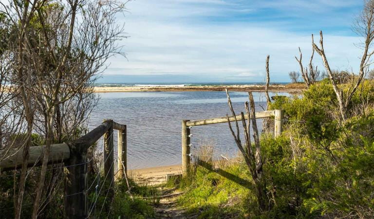
Explore your surrounds on foot and embark on a short, but scenic walk through windswept coastal heath to the sheltered Shipwreck Creek Beach. For a longer stoll, set out towards Seal Creek and explore the intertidal rockpools teeming with marine life or follow the Heathland Walk — ablaze with wildflowers through spring and summer.
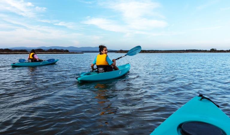
Further afield, Mallacoota Inlet is the largest tidal delta on the Victorian coast and provides ample fishing, swimming and boating opportunities. Make the most of your time at Shipwreck Creek Campground and explore all Croajingolong National Park has to offer.
Things To Do
Mallacoota Inlet

Genoa Peak

Cape Howe Wilderness Zone
How to get there
Shipwreck Creek Campground
Sites
When you're there
Need to know
Shipwreck Creek Campground
Accessibility
Visiting a park can be more of a challenge for people with disabilities, however in Victoria there are a wide range of facilities to help people of all abilities enjoy our wonderful parks around the state.
Be prepared and stay safe
Croajingolong National Park is in the East Gippsland fire district. Bushfire safety is a personal responsibility. Anyone entering the park during the bushfire season needs to stay aware of forecast weather conditions. Check the Fire Danger Rating and for days of Total Fire Ban at emergency.vic.gov.au, on the Vic Emergency App or call the Vic Emergency Hotline 1800 226 226.
No fires may be lit on Total Fire Ban days. On Catastrophic Fire Danger Rating days this park will be closed for public safety. Closure signs will be erected but do not expect an official warning.
Change of Conditions
Nature being nature, sometimes conditions can change at short notice. It’s a good idea to check this page ahead of your visit for any updates.
-
Croajingolong National Park
Aerial shooting operations targeting deer – Cape Howe
Partial park closures will be in place during these dates while aerial shooting operations targeting deer are undertaken.18-22 March 202425-27 March 202416-20 September 20249-13 December 2024See attached map for details.Attachments: Cape Howe aerial operations information (632KB)
Aerial shooting operations targeting deer
Partial park closures will be in place during these dates while aerial shooting operations targeting deer are undertaken.18-22 March 202425-27 March 202416-20 September 20249-13 December 2024See attached map for details.Attachments: Croajingolong NP aerial operations information (523KB)
Closure of the Goanna bay Jetty
Parks Victoria has recently closed the Goanna Bay Jetty (Mallacoota Inlet) for public safety reasons.The closure follows condition monitoring of the jetty that raised some concerns about its safety and structural integrity. A subsequent engineering assessment confirmed that the jetty’s condition was no longer safe for visitors.The jetty was closed on Friday 10th November and will remain so until further notice.Please note that the Goanna Bay day visitor area remains open to the public. However visitors will not be permitted to use the jetty during the closure period and will have to rely on alternative methods of safe access such as beaching or anchoring vessels to the shoreline.Croajingolong National Park information update 12 February 2024
Point Hicks Road is closed south of Bald Hills.The following six areas are closed because of the 2019/2020 bushfires and coastal erosion caused by ongoing heavy rainfall. Visitors are unable to access the Point Hicks Lighthouse, Thurra River Campground, and nearby walking tracks. Parks Victoria continue to maintain surveillance and security of these areas. Please continue to monitor this site for updates and change of conditions.· Point Hicks Lightstation· Thurra River Bridge· Thurra River Campground· Dunes Track· Saros Track· Sledge TrackThe Wilderness Coast Walk is open all the way from Bemm River to Mallacoota. Staff have recently marked sections of the track however, combined flood and fire damage have made some areas more difficult to negotiate. Hikers must be able to self-navigate with a map and compass.The following walking track is closed:· Wingan Inlet Rapids WalkThe following jetty around Mallacoota is closed:· Kingfish PointSeasonal road closures generally operate from after the long weekend in June through to the end of October, but many remain closed in areas affected by significant rainfall and flooding across Victoria in late 2022. The following tracks remain closed:· Betka Track· Miners Track· Lakeview Track· Howe Flat Track· Howe Hill Track· Barracoota TrackThe water trough at Wingan Inlet Campground is now reconnected to the creek. Visitors are reminded that this is not a potable source and must be treated before drinking.Ongoing heavy rainfall has impacted areas of Croajingolong National Park and other areas of the state. Monitor this page for updated information and site closures -
Wingan Inlet Campground (Croajingolong National Park)
Track closures at Lake Elusive, Wingan Rapids and Mt Everard
Track repairs and slashing will be conducted at Lake Elusive, Wingan Rapids and Mt Everard tracks from Mon 13 May to Fri 17 May. These areas will be closed to the public. Visitors to Croajingolong should be aware of additional trucks and roadwork signage on West Wingan Rd.Road works on West Wingan Rd
Road works will be in progress from May 15 to May 31 on West Wingan Rd near Wingan Inlet campground.
Visitors should be aware of additional heavy traffic on the road, speed limits and traffic control. -
Notices Affecting Multiple Parks
Ground shooting operations targeting deer
Control operations (ground shooting) targeting deer are undertaken in this area. The Park will remain open to visitors during operations.
Similar Experiences
Mueller Inlet Campground
Thurra River Campground
